Analysis of Australian Solar Electorates (Commonwealth)
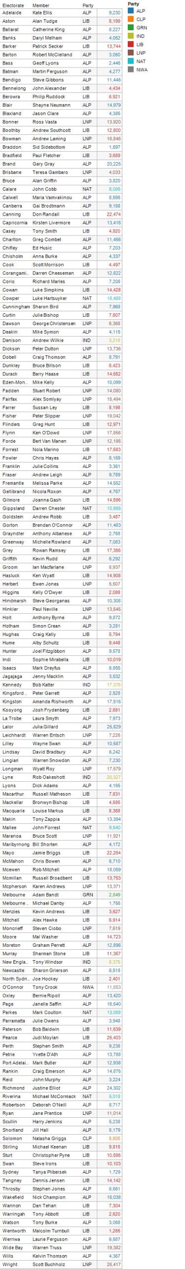
SunWiz has performed analysis of Clean Energy Regulator data to identify the top solar electorates. Use the interactive explorer below to identify the number of solar systems in your electorate. This will help you identify how popular solar has already become in your electorate, or how popular it stands to become.
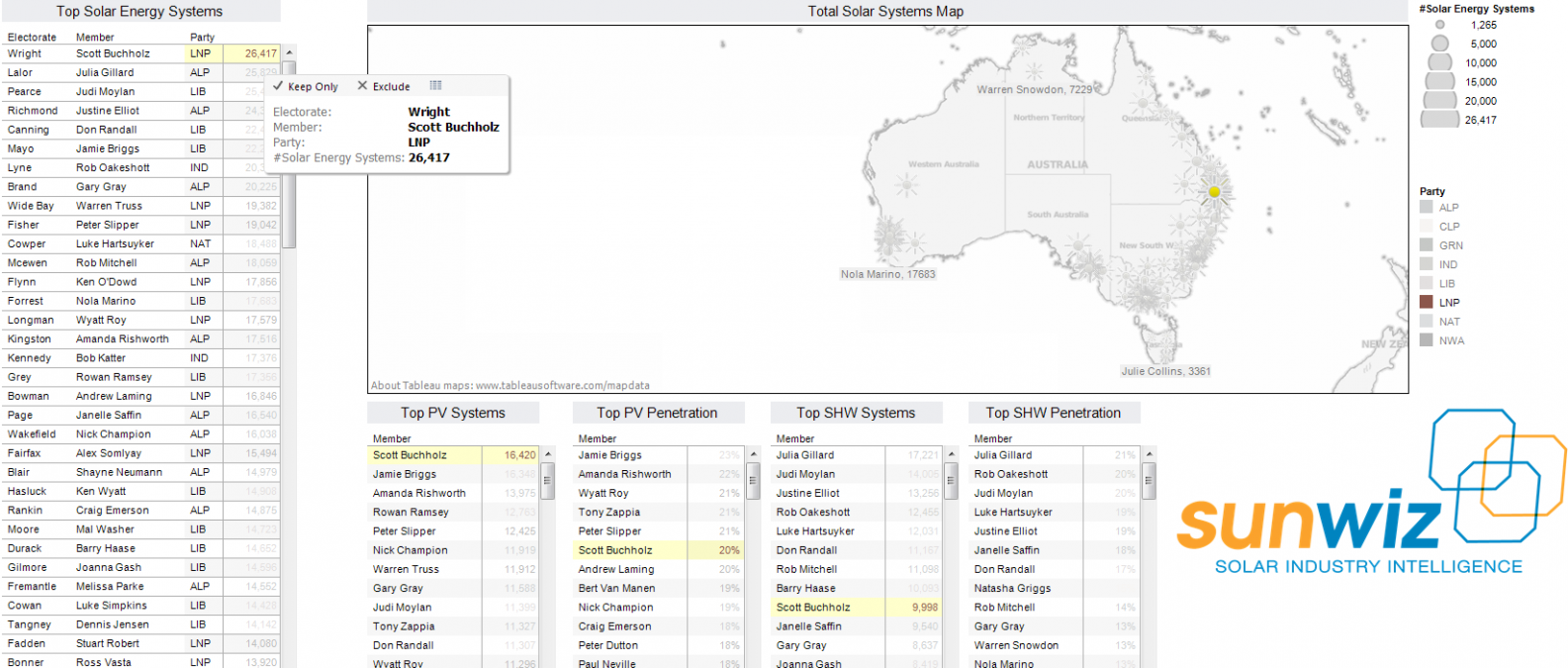
The interactive dashboard allows you to zoom in on a particular area. Hover over a sun icon to identify the electorate and its details. Hover over a name in the list of top electorates (by such measures as top # systems, and top penetration), and its location and other details will be highlighted in the other sheets. Each element can also be viewed in its own separate tab. Analysis methodology and static maps are also shown further down the page.
Interactive Dashboard
Click here to open the dashboard in full screen mode.
Snapshots from Dashboard
Click on each map to load a larger version. Please contact us on +61 1300 786 949
if you wish to publish these maps.
Methodology:
- SunWiz identified the percentage of each postcode located within each electorate by using the ABS Australian Statistical Geography Standard tables of postcode (POA vs SA1) and Commonwealth Electorate Division (CED vs SA1), joined on the SA1 identifier http://www.abs.gov.au/AUSSTATS/abs@.nsf/DetailsPage/1270.0.55.003July%202011?OpenDocument
- SunWiz took information published by the Clean Energy Regulator about the number of installations in each postcode as of 1st October 2012. http://ret.cleanenergyregulator.gov.au/REC-Registry/Data-reports. Where an electoral boundary crosses through a postcode, solar uptake within that postcode is apportioned as per the land area from step #1.
- SunWiz identified the number of dwellings in each postcode from the 2011 Census published in Table Builder by the Australian Bureau of Statistics. https://www.censusdata.abs.gov.au/webapi/jsf/login.xhtml. Penetration (percentage of dwellings with a solar system) was calculated by the sum of the systems in that area (electorate) divided by the sum of dwellings in that area (electorate). Where an electoral boundary crosses through a postcode, the number of dwellings within that postcode is apportioned as per the land area from step #1.